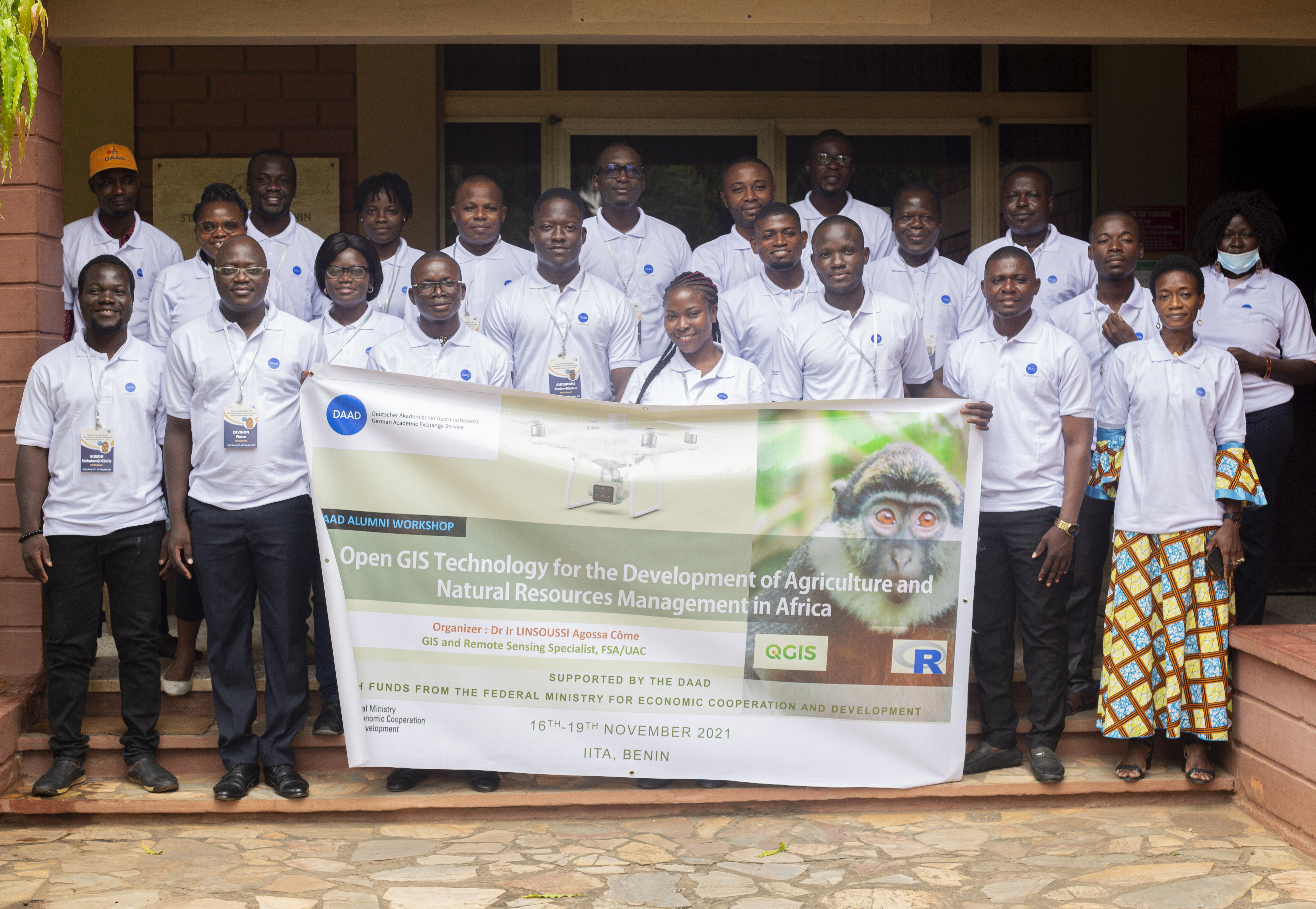
Open GIS Technology for the Development of Agriculture and Natural Resources Management in Africa
Supported by the DAAD with funds from the federal ministry for economic cooperation and development
From 16th to 19th November 2021 in Abomey-Calavi in Benin
Supported by the DAAD with funds from the federal ministry for economic cooperation and development
Open GIS Technology for the Development of Agriculture and Natural Resources Management in Africa
Supported by the DAAD with funds from the federal ministry for economic cooperation and development
Organizer : Dr. LINSOUSSI Agossa Côme
16-19th November 2021
Abomey-Calavi, Benin
The world population is currently growing at a rate of around 1.07% per year. Of this, Africa is accounted for one of the highest reproductive continent. Agriculture has a lot to do for feeding this increasing human population. In the developed countries, technologies has come into agriculture and made positive changes to face the challenges of food insecurity. Unfortunately, in Africa, the level of adoption of new technologies in agriculture is still not remarkable. Furthermore Africa’s natural resources are among those with the highest indices of degradation and mismanagement. The geographic information system (GIS) is a system designed to capture, store, manipulate, analyse, manage, and present all types of geographical data. Nowadays, GIS can be used as tool in both problem solving and decision making processes, as well as for visualization of data in a spatial environment. Timely spatial data collection, analysis and dissemination of scientific information are fundamental for interventions in managing natural resources. Building capacity in young Alumni who completed in the field of agriculture to manage the resources sustainably is very relevant. Yet commercial software for GIS is very costly and may be unaffordable for most DAAD Alumni or their employers. Fortunately, powerful free tools (such as R and QGIS) are currently available and the knowledge of their use is very valuable for African DAAD Alumni. Moreover, in GIS, raster data are very important which are traditionally acquired using satellites. Many satellites products are available on low cost (e.g. Landsat, Sentinel), yet in coastal areas these products show their limits due to many reasons including cloud cover during agricultural seasons. Drones are promising new technology to collect good quality data all year round. This workshop focused on training Alumni on tools to monitor and make decision on natural resources management. Drones were used to show the participants how to collect, process and interpret raster data in the field of agriculture and natural resources management. This capacity building served as an opportunity of technology transfer and a step towards adoption of these new technologies to strengthen agriculture systems in Africa.
Open GIS Technology for the Development of Agriculture and Natural Resources Management in Africa
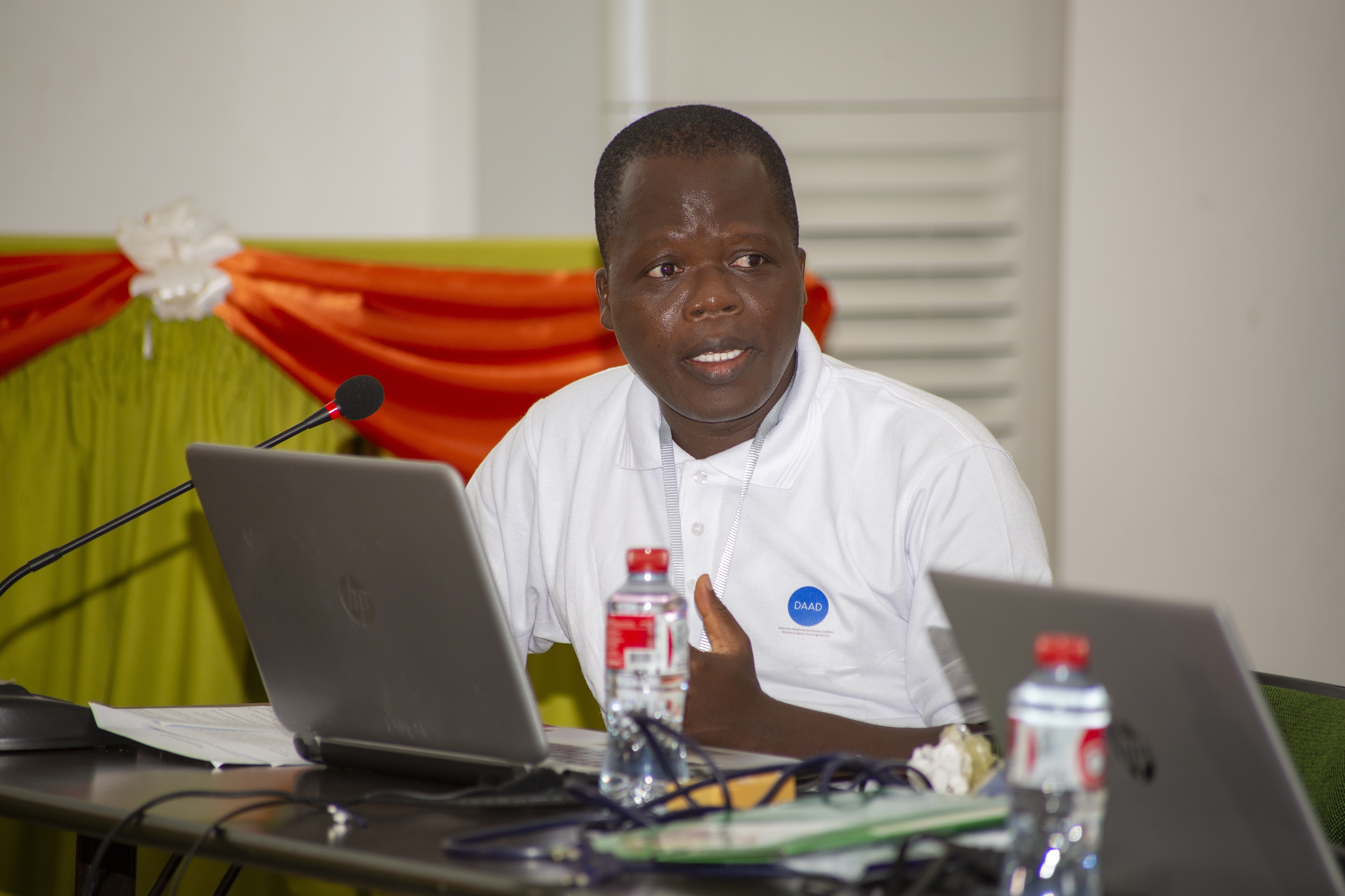
The workshop was held at the conference hall of the International Institute of Tropical Agriculture (IITA) in Abomey-Calavi. Participants got accomodation in the hotel next to the workshop site. The workshop started on 16h november 2021 in the morning around 8 o’clock in accordance with the pre-established program, with official opening ceremonies (welcome address, presentation of participants, family photo…). The first , second and fourth days of this workshop were devoted to indoor learning sessions and practical activities on computer. The learning sessions were caracterised by various slides presentations and practical exercices on computer directed by the speakers and their assistants. The first presentation of the first day was entitled "Geospatial techniques and tools role in natural resources management” and was given by Dr LINSOUSSI. That was an introductive presentation that clarified the rational of the topic of the workshop. Participants learned the importance of geospatial technologies in natural resources management and agriculture. Especially they learned the roles of GIS, Remote Sensing and GPS in the evaluation and monitoring of natu-ral resources. That talk was followed by another on “Open Geospatial technology: tools and data source”. With that second presensation, the participants got informations on various open geopspatial tools and available free data sources. Mr Zoffoun Ghislain introduced the participants with QGIS. The participants learned how to install the software, how to import vector and raster data in the QGIS. They learned various geoprocessing methods and how to query data or how to overlay layers. In the afternoon, Global Partners trained the participants on Drones. That Global Partners team explained how drones work to attendees through videos and various presentations. Participants learned about legal information of the use of drones and how to comply with the law if they intend to operate drones. Those presentations were followed by introduction of R and spatial data management with R.Open GIS Technology for the Development of Agriculture and Natural Resources Management in Africa
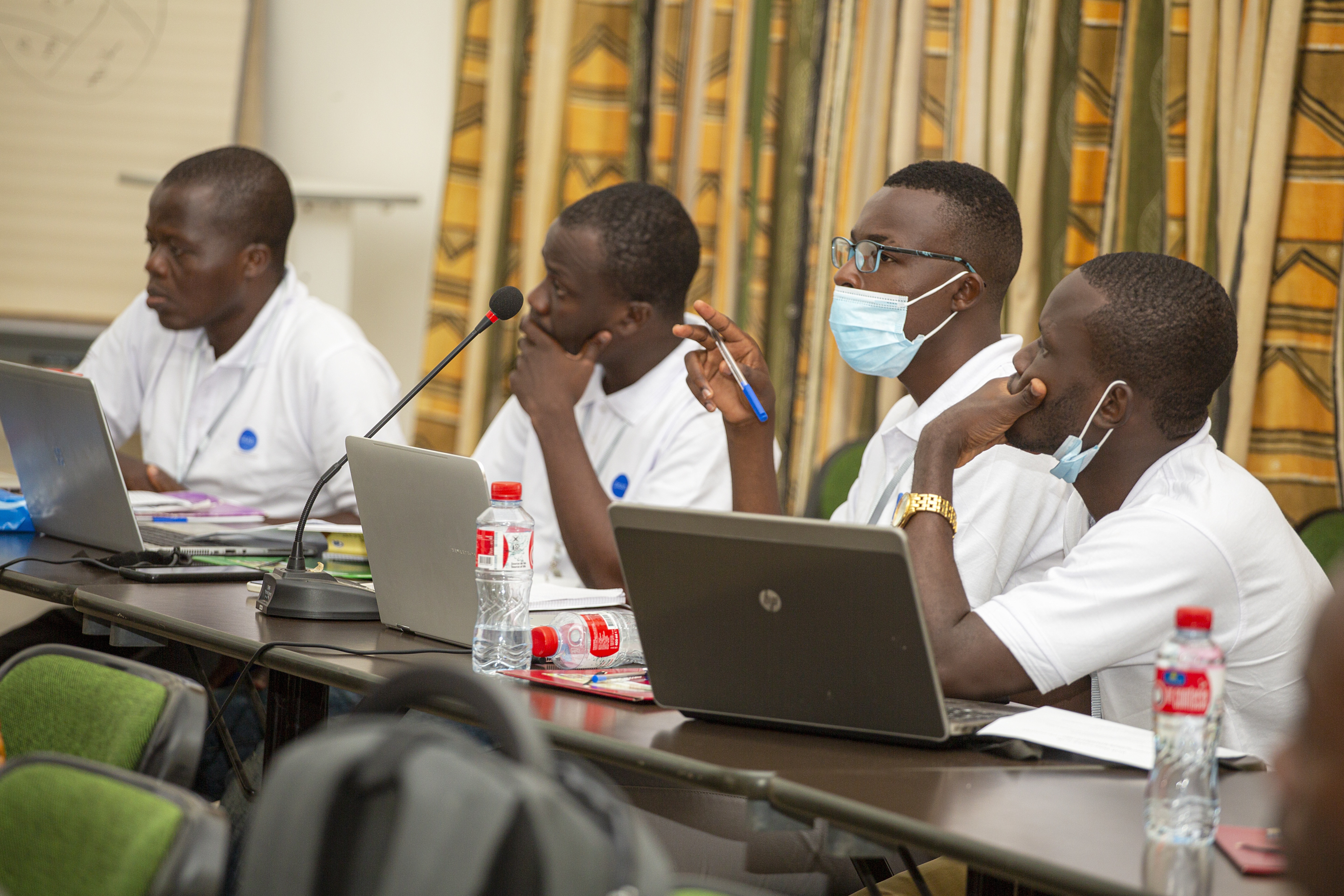
The second day was especially devoted to practical hands-on exercises. Through supervised exercises, the participants practiced the various knowledges that they acquired the first day. They were very excited to learn new concepts.They created their first maps in R. They get familiar with various mapping packages in R. They learned how to get free data from various sites (e.g. OpenStreetMap, GBIF, GADM, GSOD) directly within R through commands. They also learned how they could model spatial species distribution with R.Open GIS Technology for the Development of Agriculture and Natural Resources Management in Africa
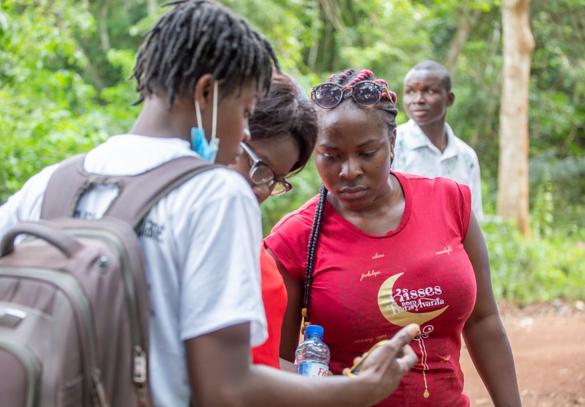
A professional excursion was organized the third day. Attendees were brought to the central region of benin for a practical session. In the forest of Lama, trainees learned how to collec t data on the field. They were trained on drones, handheld GPS and smartphone data collection techniques. They collected data on the occurrence of an endangered endemic pri-mate (Cercopithecus erythrogaster erythrogaster) in Benin. They also learned how to take raster images from drones. They collected images on land cover. The collected images were used for the classification of land use types of the study area.Open GIS Technology for the Development of Agriculture and Natural Resources Management in Africa
Mr Sydney Coffi, the first speaker of the day presented his tutorial on "Field Data preprocessing and Mapping using R", His presentation was followed by the one of Ms. Dénise AYEKO which was on the topic: “Mapping using QGIS”. On this occasion, the objective of the presentation was to use a map to provide a structural agroecological representation of the Lama forest using field data collected the day before. To do this, with the QGIS software, participants have :- imported the shapefile of Protected Areas of Benin and selected the Lama in the Shape of Protected Areas of Benin;
- added the occurrence points collected in the field during the excursion the day before in the Lama Forest;
- used geoprocessing tools to extract tracks, settlements and others features in the Lama.
- used symbology to format maps.
- to import and make image corrections of the Lama Forest raster;
- to define the region of interest (ROI) and calculate the reflectance;
- to realize the image of land use classification of the study area of study (the Lama forest);
- to convert classified images into vector data;
- to put the Raster number of each class in an attribute table.
- to classify images of the vegetation cover of the Lama forest region from 2000 and 2018;
- to cross-classify the image data from these two periods;
- to obtain the matrix of the dynamics of the maps over these two periods;
- and finally to make an interpretation of this matrix